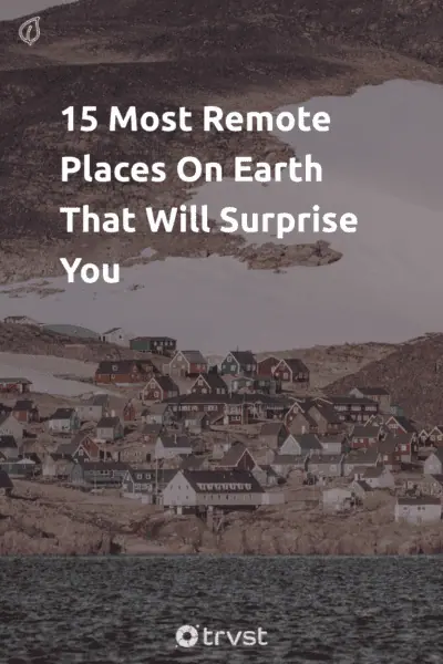
15 Most Remote Places On Earth That Will Surprise You

The world is so vast some areas can only be reached by grueling hours of traveling in different modes of transportation. That’s why some of the most remote places on Earth have a few inhabitants while others don’t.
If you are adventurous enough, exploring these places is a nice escape activity and an excellent opportunity to learn about new cultures. Imagine yourself riding planes, boats, and trucks as you explore the 15 most remote places below.
15 Most Remote Places On Earth
Table of contents:
1. Pitcairn Islands, Southern Pacific Ocean
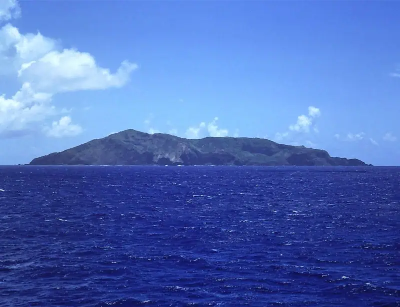
The Pitcairn Islands are a group of remote islands in Britain. These islands are Oeno, Henderson, Ducie, and Pitcairn. They are also part of the British Overseas Territory. Pitcairn Island became an official British colony in 1828 and 1856. In 1938, the United Kingdom annexed the other islands surrounding Pitcairn Island: Oeno, Henderson, and Ducie.
Oeno, Henderson, and Ducie islands are Uninhabited islands. Only Pitcairn Island is inhabited by people. These people are descendants of Her Majesty's Armed Vessel Bounty and their Tahitian companies. They named the island after Robert Pitcairn, who discovered it in 1767.
The population of Pitcairn has always been low. Between 1858 and 1864, it was 43. It peaked at 233 in 1937 but dropped to 50 in 2021. Only two children were born between 1986 and 2002. The island’s economy relies on the exportation of postage stamps, handicraft goods, various fruits and vegetables, and honey.
2. Easter Island, Chile
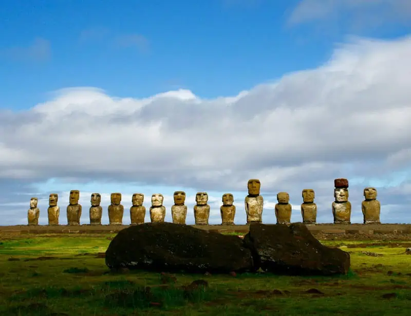
Easter Island is one of the most remote islands in the world. According to the UNESCO World Heritage Site, It has an Indigenous name, Rapa Nui.
Even though it is 3,700 kilometers from the coast of continental Chile in the Pacific Ocean, the island is a unique cultural representation of the Polynesian people who settled there in 300 A.D. People wonder who built the giant moai statues because the island is miles away from many resources.
The place has little to no drinking water, metal, or cattle. However, it does have over 300 moai statues ranging from 2 m to 20 m tall. The various positions of these statues suggest that they were built elsewhere and transported to the island.
The island has descendants of ancient Rapa Nui and immigrants of varying backgrounds. Its economy relies on tourism, and the inhabitants look forward to receiving curious visitors.
3. Devon Island, Canada
Devon Island, formerly called North Devon, is located in Nunavut, Canada, in the Arctic Ocean, south of Ellesmere Island and west of Baffin Bay. It is the largest uninhabited island in the world, measuring 53,247 square km, and the second largest island among the Queen Elizabeth Islands. William Baffin discovered it in 1616.
The island is uninhabited because it is barren. Devon Island is miles and miles of rocky and icy terrain. The island's Indigenous people, the Inuit people, left the island in the 1930s because survival was tough.
A third of the island is covered by an ice cap with a maximum thickness of 500-700 m. The rocks in the western and eastern areas are also ancient, containing Cambrian, Precambrian, and Ordovician rocks. There are also Ordovician and Silurian siltstones and shales. There are barely any plants or animals on the island.
4. Tristan Da Cunha, South Atlantic Ocean
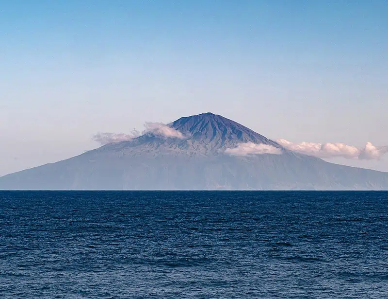
Next on our list is Tristan da Cunha. This South Atlantic Island was discovered by a Portuguese explorer in 1506. The nearest human settlement is St Helena, which is 1,510 miles away, and the next one is Cape Town,1,750 miles away.
Tristan da Cunha is a volcanic island consisting of the Nightingale, Inaccessible, and Gough Islands. It is a remote island with a narrow coastal plain and cliffs. Queen Mary’s peak, measuring 2,060 m high above sea level, is the highest point on the island. The volcano in Tristan is active, with its last eruption in 1961.
The administrator, H.H Philip Kendall (located at the Tristan settlement of Edinburgh of the Seven Seven Seas), and the governor, H.E Nigel Philps (located on St Helena), work with the Chief Islander and Tristan Island Council to ensure the smooth running of the Island.
About 300 people live in the northern coastal town of Tristan da Cunha, Edinburgh of the Seven Seas. The residents are descendants of Saint Helenians and shipwrecked sailors.
5. Kerguelen Islands, Southern Indian Ocean
The Kerguelen Islands are among the most remote places in the world. They are a group of islands in the Indian Ocean named after a French navigator named Yves-Joseph de Kerguelen-Tremarec. The islands are between Africa, Australia, and Antarctica.
This location is responsible for the islands’ extreme climate, which consists of extreme winds, rainfall, and snow. Kerguelen Islands, also known as the island of desolation, covers 6,200 square miles. It has active glaciers and high peaks measuring up to 6,445 feet. The French government established a permanent scientific center, Port-aux-Francais, on the main island in 1950.
We mentioned earlier that the Kerguelen Islands are a group of islands. It has one large island called Grande Terre and multiple small islands. Most of the island’s residents are scientists who study biology, geology, and the area's climate.
The scientists are the only residents of Kergueleen Islands because its harsh climate makes it uninhabitable for most of the human population. However, penguins and seal populations are native to the Island of Desolation. Wildlife animals use the area as a pit stop during migration.
6. Amundsen-Scott South Pole Station, Antarctica
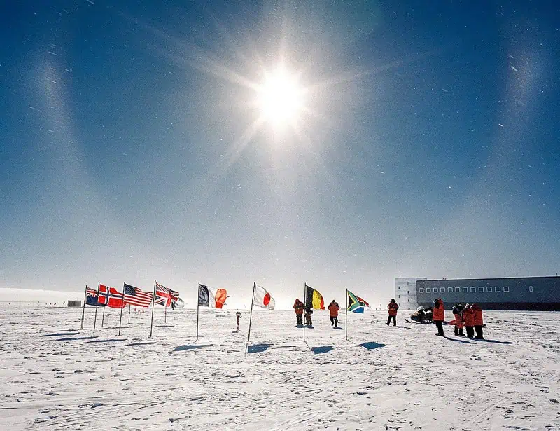
Amundesen-Scott South Pole Station is the most remote point in the world. It is located on a thick ice sheet that moves 30 feet yearly. The ice sheet is one mile thick and floats with the southern ocean currents in the middle of the United States and Mexico.
The National Science Foundation built the first Amundesen-Scott South Pole Station in 1957, but it was buried beneath drifting snow. They built the second station at the South Pole in the 1970s, but it was also destroyed by the ever-accumulating snow.
The National Science Foundation finished the third building around 2010. They designed it to rise above Antarctica’s ice sheet, allowing blowing snow to drift beneath it. The design also raises the structure hydraulically to improve the station’s lifecycle.
The station has rooms, dining, communications, recreation, science labs, and administration areas to cater to about a hundred people. The fuel and cargo storage, maintenance garages, power plants, and waste management systems are underneath the ice sheet.
7. Palmerston Island, Pacific Ocean
Palmerston Island is a coral atoll in the Pacific Ocean, about 470 km northwest of Rarotonga. It is part of the Cook Islands, which includes Rarotonga and Aitutaki islands.
Captain James Cook recorded the first sighting of Palmerston Island in 1774, but William Marsters, an English man from Gloucester, was the first settler. He settled with three Polynesian wives in 1883 and produced 23 children and 134 grandchildren. Everyone living on Palmerston can trace their lineage to William Marsters.
No, they don’t marry within the family branch. In fact, marriage within the family is banned. The highest point on the island is a man-made mound called Refuge Hill. The hill is about 6 m tall. The only means of transportation to reach the island is by boat. Also, they do not have access to many resources.
The entire island depends on the supplies delivered by a cargo ship from Rangiroa, the largest city in the Cook Islands. The boat provides supplies three times a year. Palmerston Island’s economy relies on the exportation of flash-frozen parrotfish. The nearest airport to the island is in Rangiroa.
8. Adak, Alaska

Located on the western tip of the Aleutian Islands, where the Bering Sea meets the Pacific Ocean, Adak Island is miles away. It shares the same time zone as Hawaii, but it does not share its own state, Alaska.
The early inhabitants of the island, the Aleuts, survived the harsh climates of Adak by hunting whales, seals, otters, sea lions, and island birds. Adak Island is prone to earthquakes and heavy gusts of wind. The Aleuts created waterproof clothing to handle the cold climate. Other nations, like Russia, discovered and visited Adak in the early 1740s. They started trading in the 1750s.
Russians took over the island and relocated the Aleuts to Russian settlements in Kodiak, Sitka, and the Pribilof islands. However, the United States repurchased the island from Russia in 1867. In 1940, the island became part of the National Wildlife Refuge System. During World War II, the United States used the island as a naval base.
They ended military operations on Adak Island on March 31, 1997. As of today, the island has less than 400 inhabitants. Their source of income is the commercial fish processing industry.
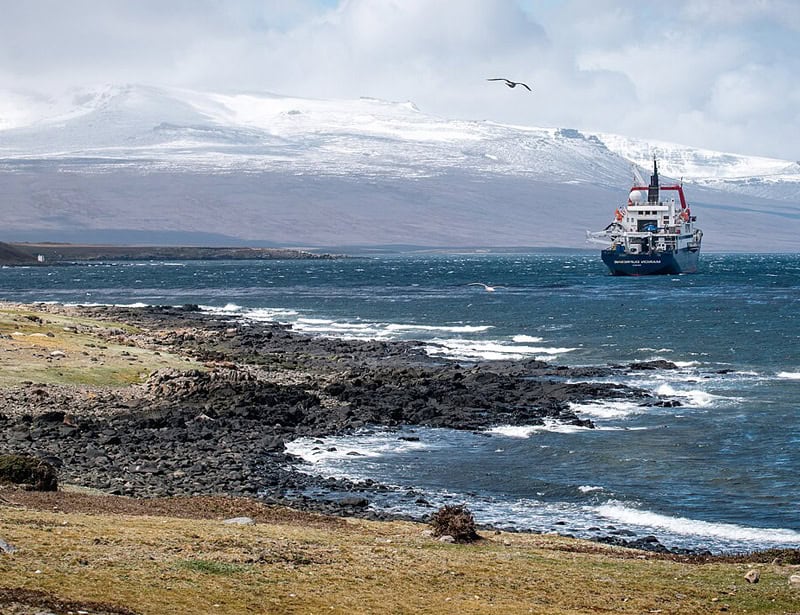
9. Villa Las Estrella, Antarctica
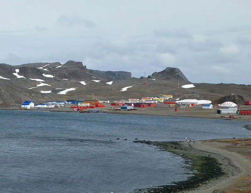
Villa Las Estrella (Spanish for Stars Town) is another isolated place in Antarctica, on King George Island. It is 75 miles from the coast of Antarctica and 2,000 miles from Chile and is the smallest inhabited remote location in the world.
During harsh winter seasons, the population is less than 100, but it increases slightly over 100 during the winter period. This Chilean village has 14 houses, which include a church, a small school, a post office, a bank, a gym, and a souvenir shop. The small school has only two teachers overseeing its affairs.
People deciding to live long-term in the middle of nowhere village have to remove their appendix before moving because the nearest hospital is 625 miles away. The residents transport themselves using a tracked vehicle or boat. You can get to or leave the island by a two-hour flight or cruise ship.
10. The Changtang, Tibet
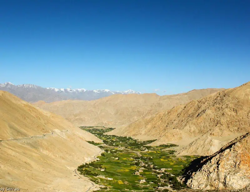
Chang Tang is one of the last wild landscapes in the world. Located on the Roof of the World, the western area of the Tibetan plateau, Changtang is 700,000 square kilometers. It is an uninhabited land with snow-capped mountains and rolling alpine steppe. Changtang's elevations range between 4,300 and 7,000 m.
The Tibetan plateau is 2.5 above sea level. Changtang’s climate is as cold as the Arctic Circle, with short summer seasons. It is home to several wildlife species like snow leopards, Tibetan wild asses, brown bears, blue sheep, chiru, wild yaks, and Tibetan sand foxes.
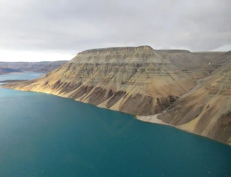
11. Ittoqqortoormiit, Greenland
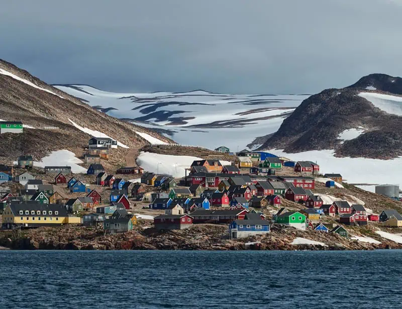
Next on our list of the most isolated places in the world is Ittoqqortoormiit. Ejnar Mikkelsen, a Danish explorer, founded the small village in 1925. Archeological research shows that the ancient population of Greenlandic Inuit used to live there. Ittoqqortoormiit is smack in the middle of the Arctic Circle, located 70 degrees north on the central coast of East Greenland.
It is home to polar bears because it is one of the coldest places in the world. They only experience two summer months (June to July). During summer, visitors can sail through the fjord system of Scoresby Sund because fjord ice returns in October or November. You can also see the northern lights during early or late summer periods.
The majority of the small population of Ittoqqortoormiit are hunters. They hunt arctic animals, such as musk oxen, seals, walruses, whales, and arctic foxes. They hunt musk oxen twice a year, in August and March, using two hunting methods: speedboat hunting in August and dogsled hunting in March.
12. La Rinconada, Peru
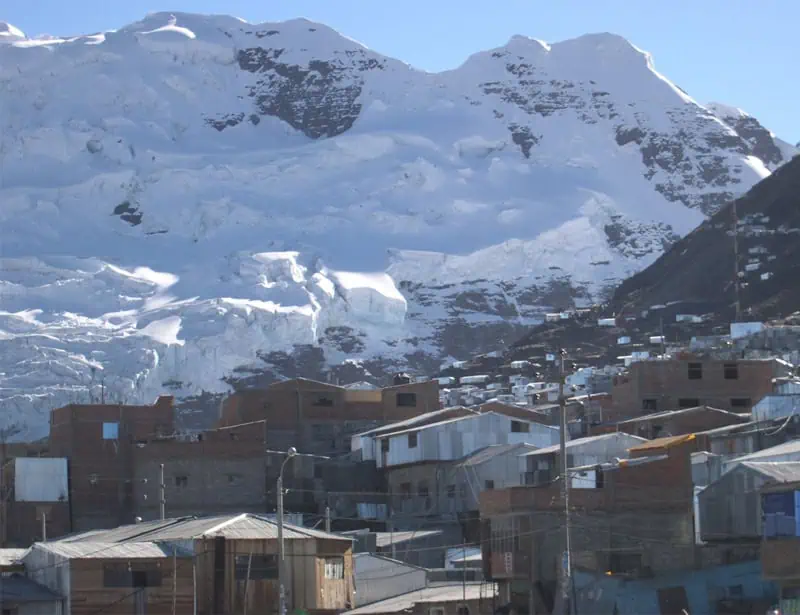
La Rinconda is the highest city in the world, elevated at 5,100 m above sea level. The city is well-known for its gold mines. That is all tourists want to explore: the gold mines of La Rinconada. Initially, La Rinconda was supposed to be a temporary mining town.
However, many people emigrated to remote areas to work in the mining industry. In nine years, the city’s population increased by 230%. People keep emigrating to the land of gold despite the terrible living conditions. Because of its high altitudes, La Rinconada has a low oxygen concentration.
The city's living conditions are also poor because there is no indoor plumbing, sewage system, or permanent city services. Treacherous roads lead to the mine, which is only accessible by trucks. Also, the mining company in charge of the mining operations in La Rinconada exploits its workers.
Corporacion Anaea employs workers with a system referred to as cachorreo. The system requires workers to work 30 days without pay, and on the 31st day, they pick as much gold as they can extract from the mine. People keep accepting Cachorreo employment contracts because they have high hopes of making a fortune with gold.
These days, it’s challenging to find large chunks of gold in the mine. However, reports from 2011 showed miners mined 150 tons of gold. Women do not work in the mines, but they collect gold remains and throw them to the outskirts of the mine.
13. Oymyakon, Russia
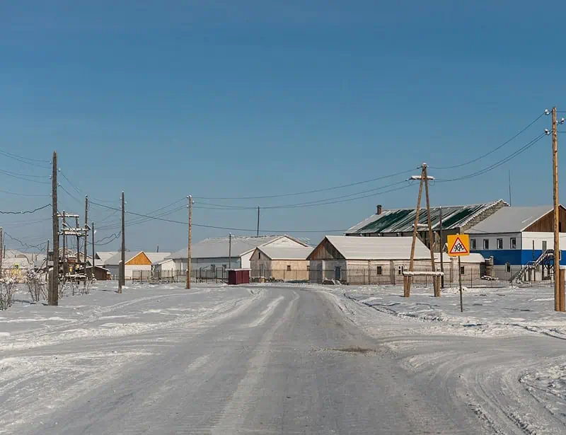
Oymyakon is the coldest place in the world, which is ironic, given the English translation of the city's name is ‘water that doesn't freeze.’ Winter herders established the region in the 1920s because they watered the herd at the thermal spring.
Almost everything in Oymyakon is frozen. The pipes freeze, so plumbing systems are not available. Plants barely grow because of the extreme cold, so residents predominantly rely on meat and fish. Also, burial sites are not available because the ground is too hard.
14. Longyearbyen, Norway
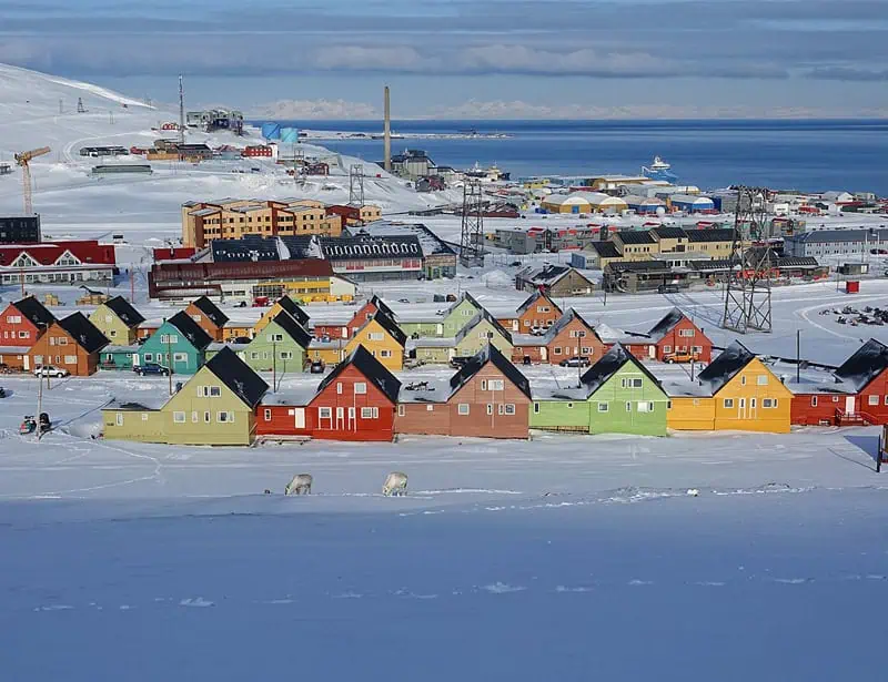
Longyearbyen is one of the remote places close to the North Pole. It is 1,300 km away from the North Pole. You can view the northern lights from here. The community is primarily international, with about 2,300 residents.
From April 20 to August 23, Longyearbyen experiences endless daylight. The region has many unique natural phenomena, and it's worth a visit. Additionally, there are no maternity wards in Longyearbyen. Pregnant women have to travel to the mainland 3-2 weeks before their due date.
15. Helena, South Atlantic
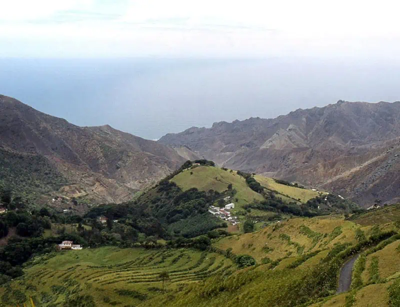
St. Helena Island is a British overseas territory that includes three other islands, one of which is Tristan da Cunha, the farthest island in the world. St. Helena is 10.5 miles long and 6.5 miles wide. There used to be volcanic activities on the island, but it is now extinct. Volcanic eruptions are responsible for most of its landscapes- cliffs and mountains.
The island has three vegetation regions: rocky, barren, and marine areas. There are grassy plains, poplars, cactus, scotch pines, and willows. Many species are native to the island, including oaks, cedars, bamboo, and bananas.
Glossary Terms:
Jen’s a passionate environmentalist and sustainability expert. With a science degree from Babcock University Jen loves applying her research skills to craft editorial that connects with our global changemaker and readership audiences centered around topics including zero waste, sustainability, climate change, and biodiversity.
Elsewhere Jen’s interests include the role that future technology and data have in helping us solve some of the planet’s biggest challenges.
Fact Checked By:
Isabela Sedano, BEng.