Interview: Dr. William B. F. Ryan, Pioneering Marine Geologist and Geophysicist
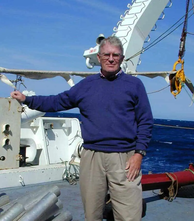
Dr. William B. F. Ryan is a pioneering marine geologist and geophysicist at the Lamont-Doherty Earth Observatory of Columbia University. He has held various senior research and adjunct professor roles at Columbia University since 1969. Even after his official retirement from teaching in 2004, he continues to publish research as a Doherty Senior Scholar, recently focusing on the anniversary of the Mediterranean desiccation hypothesis.
Dr. Ryan was part of the "new generation" of scientists at Lamont in the late 1960s who helped validate the theory of plate tectonics. He co-authored influential papers on the evolution of the Alpine system, attributing the region's geological complexity to the shifting boundaries between the African and Eurasian plates. He is a foundational figure in marine geology—his career essentially spans the "Golden Age" of oceanography, from the birth of plate tectonics to the high-resolution digital mapping we use today. As Dr. Ryan is a lead developer of MapMaker and contributed to the Global Multi-Resolution Topography (GMRT) synthesis, which provides high-resolution digital imagery of the world's ocean floors for tectonic studies.
Dr. Ryan is best known for his research on the plate tectonics and geological evolution of the Mediterranean and Black Seas.
The Messinian Salinity Crisis: The discovery that the Mediterranean Sea once turned into a "Deep Dry Desert" is one of the most dramatic findings in Earth history. The Zanclean Megaflood (5.33 Million Years Ago) explains how the Mediterranean Sea was refilled after the Messinian Salinity Crisis, a period during which the basin had almost completely dried up due to evaporation and tectonic closure of the Strait of Gibraltar. Tectonic shifts or rising sea levels caused the Atlantic Ocean to breach the land bridge at the Strait of Gibraltar, with water surging into the desiccated basin with a discharge rate roughly 1,000 times that of the modern Amazon River. It is estimated that 90% of the Mediterranean refilled in just several months to two years, with water levels rising as much as 10 meters (30 feet) per day in certain areas.
Dr. Ryan's work in the 1970s with the Glomar Challenger mission identified massive salt deposits and deep-sea canyons carved by the force of the incoming water. The Mediterranean likely sat as a vast, arid basin to kilometers below sea level for millions of years.
The Black Sea Deluge Hypothesis: The book Noah's Flood (1998) remains a fascinating bridge between geological science and cultural mythology. Alongside Walter Pitman, Dr Ryan proposed that a catastrophic flood occurred around 5,600 BC when Mediterranean waters breached the Bosphorus Strait due to rising sea levels, suggesting a rapid, catastrophic influx of Mediterranean water flooded a freshwater lake around 5600 BC (approximately 7,600 years ago). That this flood could have been the historical basis for the Biblical story of Noah and other Middle Eastern flood myths.
1. Tell us about your journey to becoming a pioneering marine geologist.
I met Jacques-Yves Cousteau in 1961 on my first oceanographic expedition in the Mediterranean. Our research vessel, the R/V Chain of the Woods Hole Oceanographic Institution, was scheduled for a two-ship experiment to measure the thickness of the Mediterranean sediments using the then state-of-the-art technology. I spent several days aboard a ship belonging to the Musée Océanographique de Monaco while recording the sounds transmitted from the Chain as acoustic waves from explosions entered the sediments and refracted off the various layers of buried sand and clay, including the solid bedrock beneath the sediment cover.
I had just graduated from Williams College with a major in physics and was using this knowledge to determine the velocity in which the waves passed through the sediments. If the sediments were thin, it meant that the Mediterranean offshore of France was young. It turned out that the survey presented more complicated results, an unexpected hard layer barely 1 km beneath the sea floor, and another hard layer 2 to 3 kilometers further beneath the sea floor, which was most likely the bedrock.
Our echo-soundings had shown numerous knolls that Jacques-Yves Cousteau called “petits accidents” on an otherwise flat seafloor. The mounds were 10 to 30 meters high and appeared to be protrusions of material that had come up from below the shallow hard layer.
This was our very first clue that the Mediterranean might have a buried layer of salt, which came as an astonishment to everyone, including our French colleagues. Two months later, we returned to Monaco and spent Thanksgiving in the harbor with our invited guests, Prince Rainier and his wife, the former actress, Grace Kelly, in our messroom aboard the Chain.
2. You are a foundational figure in marine geology. Historically, many great scientific breakthroughs were initially ignored or ridiculed and were only accepted after intense, long-term persistence, often taking decades to overcome initial skepticism. What were the challenges in putting forward pioneering scientific discoveries, and how did you overcome the resistance?
I recall three challenges that took some time to overcome. The first was my PhD dissertation. I had participated on four oceanographic expeditions in the Mediterranean using the techniques of seismic reflection profiling, accompanied by measurements of variations in the earth’s gravity and the earth’s magnetic field, and the rate in which heat from the earth’s interior passes upward through the sediments.
The measurements and calculations revealed that the eastern Mediterranean was very old, but its surficial sediments were being actively folded into a ridge seaward of a deep trench. This indicated to me that the Mediterranean was sliding under the Aegean Sea, a then controversial process in the early 1960’s called subduction. The sediments were being scraped up like snow that piles up on a shovel pushed along a driveway. My dissertation examination committee would have none of this argument that contradicted their view that continents had never drifted apart. They would only accept my thesis if and when it was published under peer review in a prestigious journal. This delayed my PhD diploma by a year.
The second challenge came soon afterwards. I had been selected as a chief scientist aboard the drill ship Glomar Challenger on Leg 13 of the Deep Sea Drilling Project. I was once more back in the Mediterranean. The hard layer discovered in 1961 did indeed turn out to be the top of a 1 km thick layer of salt. The sand and gravel on top of the salt contained shells of clams and mussels that had lived in fresh and shallow water. This suggested to Ken Hsü, Maria Cita, and myself that the Mediterranean had actually dried up at the end of the salt precipitation.
The first layer of settlement just above these shells indicated that the nearly dry Mediterranean Sea had suddenly filled with salt water, a gigantic flood. These were indeed surprising and astonishing findings. Our hypothesis that the Mediterranean had almost fully desiccated 5 million years ago was too outlandish for the other scientists aboard the drill ship and months later by the broader geological community. Although the desiccation hypothesis has become widely accepted in the subsequent decades, there still are a handful of sceptics.
The third challenge came in 1980. A group of Texas oilmen had decided to search for the Titanic. I read their announcement in the back pages of the New York Times and sent a postcard suggesting a colleague of mine at the Scripps Institution of Oceanography had the technology required. However, the Scripps equipment was committed elsewhere that summer. Rather than delay the search, I was asked if Columbia University could accomplish the task. I replied that I had no equipment. They replied back, “build it!"
After a month of discussions with the machine shop at the Lamont Doherty Earth Observatory and our electronics engineers, I decided to write a proposal that would outline how we would do a search and what equipment we would build and assemble. I charted a ship out of Fort Lauderdale, Florida, and had winches and cranes shipped from California, 25,000 feet of cable from Virginia, and electronic components from the states of Washington and Utah. Much of the equipment only came together to be assembled on the dock in 5 days prior to setting sail. Enroute to the Titanic distress location, we tested the equipment for the first time in deep water. It worked!
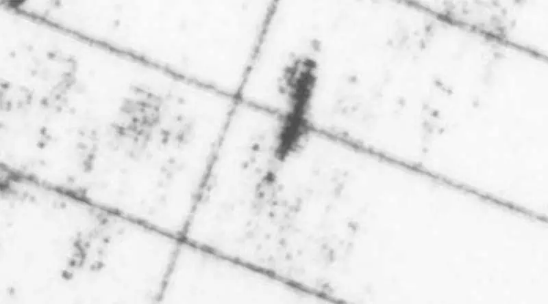
On August 7, the eighth day of the search, we encountered an acoustic target that provided exceptionally strong reflected energy transmitted from our side-looking sonar, which was being towed 100 meters above the seabed, more than 2 miles below the sea surface. This object, whatever it was, became our target number 9.
The problem was that this target was only 600 feet long and not the full 880 feet of the Titanic’s hull. Furthermore, this target was 14 nautical miles away from the Titanic’s distress position. A navigation era of that magnitude could never have occurred. Therefore, we continued our search and were able to thoroughly cover 400 square nautical miles of the seafloor, which is about the size of the state of Rhode Island. No other similar target appeared.
We returned to the search area with equipment of the Scripps Institution of Oceanography the following year, and one by one we passed over 12 of the 13 1980 targets using a combined side-looking sonar, magnetometer, and video camera vehicle. No target provided a magnetic signature or video evidence. However, target number nine lay outside the listening range of our sea-bed acoustic beacons used to navigate the towed instrument, due to its vast distance from the distress position.
In the last day prior to our scheduled return to Boston, I deployed for the first time our new color video camera system constructed at Lamont and towed it on our 25,000 foot long of cable without seabed beacon navigation toward target number nine. Some hours into the tow the camera system encountered ng a large object and tilted on its side, producing a loud scraping sound. The video caught the shape of a curved object. When retrieved, we developed the 35 mm color film from another camera that had been set to flash a new exposure every few seconds. A mosaic was assembled that showed we had encountered with appeared to be the blade of a large propeller.
For some of us, including myself, this was not sufficient evidence of the Titanic, but for Jack Grimm of the Grimm Oil Company and the captain of our survey ship, the R/V Gyre, this was indeed convincing. When Mr. Grimm returned to his office in Abilene, Texas, there was a photo on his desk of the propeller salvaged from sistership of the Titanic that had exactly the same shape as in our mosaic.
In 1983, en route to the Mediterranean aboard the Columbia’s research vessel that Robert D Conrad, we passed once more over the search site. Our sonar revealed a long trail of debris that ended at target number 9. We surmised that the debris might have been coal spilled from a ruptured Titanic.
In 1985, Robert Ballard and his French colleague, Jean Louis Michelle, conducted their search first with a French side-looking sonar and later with Ballad’s video camera system. They chanced upon the Titanic at site number 9. The Titanic had broken apart with the bowel section about 800 m north of the stern section with its protruding propeller blades. Ballard exploited the trail of debris to lead him to the wreckage, that he so splendidly photographed and that brought him and the Woods Hole Oceanographic Institution much well-deserved acclaim. However, with Mr. Grimms suggestion, I had already given Jean Louis Michelle copies of our sonar imagery, bathymetric maps and the locations of all of our targets before their endeavors. In fact, I had published the final reports of our 1980 and 1981 surveys in a journal of the Nautical Navigation Research Society called “Ship to Shore” in 1982 and a map with the target location in British journal in 1983. Neither Ballard nor Jean Louis Michelle have ever acknowledged our notable contribution to the location of the Titanic.
3. You are widely recognized for your contributions to "Plate Tectonics Revolution," specifically regarding the evolution of ocean basins. Tell us about the factors that helped you bring a new understanding of plate tectonics.
I was not a major contributor to the initial Plate Tectonic Revolution in 1968, except for the recognition of scraped-up sediments in the accretionary prism seaward of the trench with Philip Rabinowitz in 1970. My later contributions were to the understanding of the subsidence of the edges of the rifted continents with Anthony Watts in 1976, to the rollback of the subducting plate with Alberto Malinverno in 1986, and to the periodic eruption of seafloor lava at mid-ocean spreading centers with Ellen Kappel in 1986.
4. You are widely recognized for your contributions to the geological history of the Mediterranean and Black Seas. Tell us about the factors that helped you bring a new understanding to the two major geological flood theories: the Zanclean Megaflood (5.33 million years ago) and the more recent Black Sea Deluge Hypothesis (c. 7,600 years ago).
The Zanclean Maga Flood is real despite all efforts to suggest that neither it didn’t occur or was minor in its amplitude. I published in 2023 a lengthy review titled "50th anniversary review of the Mediterranean desiccation hypothesis” in the journal La Rivista del Nuovo Cimento, available at: https://doi.org/10.1007/s40766-023-00042-9. There are always detractors. They typically use a single line of evidence and ignore all of the other collaborating evidence. They overlook, for example, the discovery of riverbed gravels more than 2500 meters below the sea surface that are directly overlain by deep sea marine ooze.
At numerous locations around the Mediterranean, one finds terrestrial deposits with remains of mammals, snails, and plants directly overlain by deep sea marine sediments. As one example, there are teeth from a hamster on the island of Mallorca from a species that had travelled from mainland Spain. The hamster could only have migrated to the island by a land passage that is now more than 800 to 1200 meters below today’s sea surface. The occurrence of larger mammals such as crocodiles in the terrestrial deposits of the Moncucco quarry in the Piedmont Basin of Italy affirm even greater distance migration from Africa by way of terrestrial corridors across a dried-up Mediterranean. The mammals include the hippopotamus and camel, which are unable to swim the distance or ride on rafts.
The Black Sea Flood is still quite controversial. Our initial dating back in 1996 with radiocarbon methods did not have an adequate calibration to changes in the reservoir age of the Black Sea’s water. The corrected calendar age is now earlier, and 9,300 years before the present. Subsequent to our 1996 publication, we now have a more definitive signal from an extremely abrupt change in the strontium isotopes instead of using the replacement of freshwater mollusks with saltwater mollusks that may have taken place more gradually.
It is natural for catastrophic hypotheses to be challenged and looked at critically by the broader research community. Such analysis is welcomed, and now has occurred in many publications about the passage of the Black Sea freshwater lake to its present-day saltwater sea. Since our discovery of drowned shorelines as deep as 140 m below today’s sea surface on the Ukraine and Russian margins that contained remains of plants with their roots, there has been more than 100 publications inspired by this discovery. It has opened a whole new area of inquiry undertaken by teams of Ukraine, Romanian, Bulgarian, Canadian, Israeli, and Turkish scientists that went dormant in the years after the collapse of the Soviet Union. There are now more than 400 publications on the Mediterranean’s Salinity Crisis inspired by the first deep-sea drilling in 1970.
5. A new article published in February 2026, written by Dana Mckenzie titled "The Cataclysmic Flood That Wasn't," challenges the long-standing geological theory of the Zanclean flood. The article explores recent research suggesting that the Mediterranean Sea may not have been refilled by a sudden, massive deluge 5 million years ago as previously believed. What are your thoughts on the analysis and conclusions presented in this new article?
It is now to all to familiar how manuscripts such as “The Cataclysmic Flood That Wasn't" by Dana McKenzie get through a vigorous peer-review process.
6. Is the understanding of the geology of our world constantly changing due to new natural forces, some of which are man-made and technologies such as artificial intelligence?
The chemistry of the atmosphere and oceans is definitely changing, as are their patterns of circulation. Humans are depleting reserves of water stored in subsurface aquifers at a rate exceeding their refilling. Sea level is currently rising at rates greater than those observed in the past geological history, going back tens of millions of years ago.
7. How can people reach you?
billr@ldeo.columbia.edu
Glossary Terms:
Selva Ozelli Esq, CPA is a legal and finance executive with diversified experience dealing with highly complex issues in the field of international taxation and related matters within the banking, securities, Fintech, alternative and traditional investment funds. Her first of its kind legal analyses involving tax laws, Foreign Corrupt Practices Act (FCPA), blockchain technology, solar technology and the environment and have been published in journals, books and by the OECD. Her writings have been translated into 15 languages.