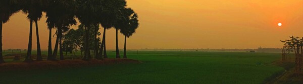
Interview: Dr Michael Steckler, Geophysicist and Lamont Research Professor
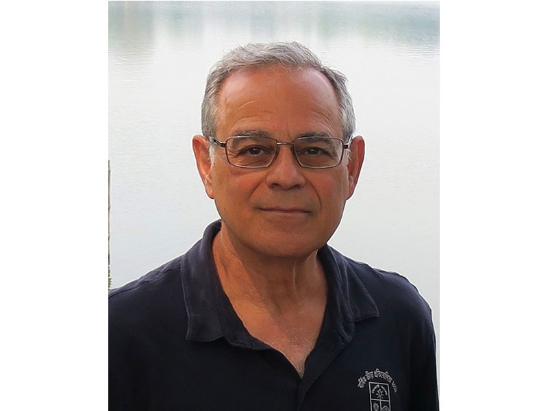
Dr. Michael S. Steckler is a prominent geophysicist and Lamont Research Professor at the Lamont-Doherty Earth Observatory (LDEO) of Columbia University. He also serves as the Associate Director of the Marine and Polar Geophysics Division at LDEO.
Dr. Steckler's research focuses primarily on sedimentary systems, exploring the intersection of tectonic forces, earthquakes, and sea level change.
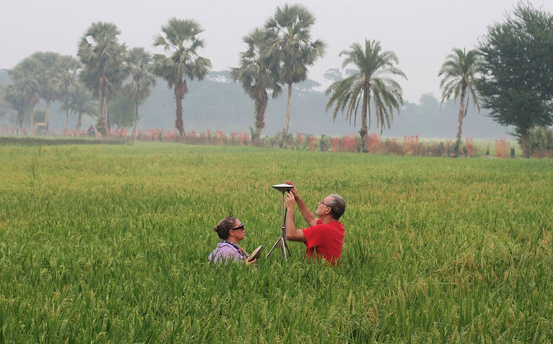
His most extensive field research centers on Bangladesh and neighboring regions (India and Myanmar), where he has worked for over 25 years. Dr. Steckler uses high-precision Global Navigation Satellite Systems (GNSS) alongside tools like Rod Surface Elevation Tables-Marker Horizons (RSET-MH) to measure how fast the land in the Ganges-Brahmaputra Delta is sinking. This research tracks how land subsidence and sea-level rise balance against river sedimentation.
His structural geophysics research has identified major undocumented ancient earthquakes, including a massive tremor that permanently shifted the course of the lower Ganges River.
Beyond South Asia, his historical and ongoing projects span Jamaica, Italy, Turkiye, Egypt, Israel, Jordan, Mexico, Haiti, Spain, France, Canada, and New Jersey.
Dr. Steckler earned his B.S. from the Massachusetts Institute of Technology (MIT) and completed his Ph.D. at Columbia University in 1981. Following a postdoctoral fellowship at the University of Cambridge, he returned to the Lamont-Doherty Earth Observatory, where he has been a researcher since 1982.
1. Tell us about your journey to becoming a prominent geophysicist
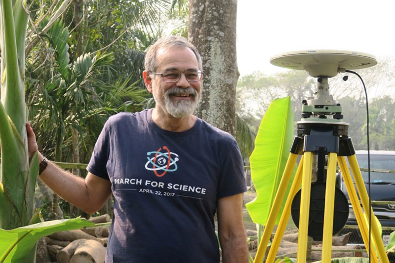
I was interested in science from a young age and attracted to physics, but was unsure of which field within physics. When I looked into geophysics, I discovered that plate tectonics had just completely upended our understanding of the world. The excitement in the earth sciences department was palpable and pulled me into studying the earth.
2. Did you have any role models
Many people. Tanya Atwater and John Sclater as an undergraduate. In grad school, my advisor Tony Watts, Walter Pitman, and many more. Plus lots of peer colleagues that have influenced my science trajectory.
3. You have focused your research for the past 25 years on Bangladesh and neighboring regions (India and Myanmar). Tell us why.
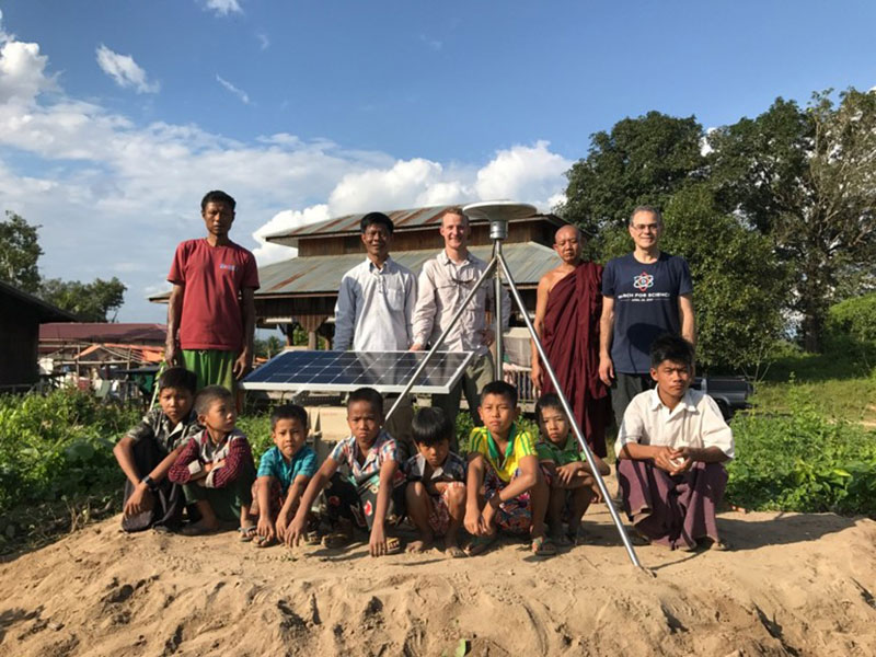
We initially started some small projects there, and during visits I discovered the huge breadth of exciting earth science to be done there, most of which was vastly understudied. It has the continuation of the subduction zone from Sumatra that is the only subduction zone entirely on land, the world’s largest delta, which is amazingly dynamic, and their interaction, including things like large earthquakes causing rivers to shift.
4. During the 2004 Indian Ocean tsunami, which killed nearly 230,000 people across the region, Bangladesh recorded only two fatalities. Tell us why
The tsunami mainly propagated east and west from the north-south fault, so Bangladesh, which lies to the north, missed the brunt of its force. Its very wide continental shelf and extensive coastal mangroves also dissipated much of the energy. Still, every pond in the country was sloshing back and forth from the earthquake.
5. What was the role of Bangladesh’s soft, malleable coastline that is heavily built up by river sediments from the Ganges and Brahmaputra rivers during this tsunami?
As stated above, it was mainly the broad shallow continental shelf and large mangrove forests that protected Bangladesh. In a 1762 earthquake an estimated 500 people died in Dhaka, the capital from an estimate M8.5 earthquake along the coast of Myanmar and southernmost Bangladesh from a flood wave traveling up the river.
6. You have led a groundbreaking study published in Nature Geoscience that identified a hidden subduction zone lurking directly beneath Bangladesh and eastern India with your data models indicating that the fault is locked and building massive pressure. When it inevitably ruptures, it could trigger an earthquake ranging from 8.2 to 9.0 magnitude, making it one of the largest ever measured. Tell us about your study.
We used GNSS (GPS) to image the strain building up along the subduction system. The GPS we use can measure position to ~2 mm horizontally, so monitoring for years, we can see rates of the land being squeezed to less than 1 mm/y. That study also brought a lot of press and panic. A follow-up study involving additional GPS instruments in Bangladesh and Myanmar lowers the earthquake size to ~M 8.2. We were able to show a major fault in Myanmar was active, decreasing the motion on the subduction mega thrust. We still do not know when it might occur, whether it could soon or not for many hundreds of years.
7. How can the soft river sediments making up Bangladesh's ground amplify shaking during an earthquake, exacerbating the threat to coastal infrastructure?
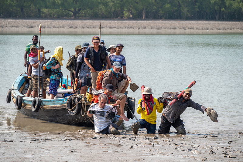
The thick, soft sediments beneath Bangladesh can slow seismic waves increasing their amplitude. They can also reverberate within the basin. For this, a lot depends on the resonant frequencies of the basin and the buildings. The basin is so large that they may mismatch, but some subbasins could be impacted. We have also seen sediment liquefaction from earthquakes could be an issue, especially if an earthquake occurs during the rainy season.
8. In February of this year, two 5.4 magnitude earthquakes within 24 hours struck the Khulna region, triggering panic in an area not typically known for seismic activity. Are these earthquakes a run-up to the big one you predict?
No, I do not think they are. The one near Dhaka was in the lower subducting plate as it deforms entering the subduction zone. It was much deeper and separate from the megathrust that could host the big one.
9. Tell us about your research in Turkiye, which will host the 2026 UN Climate Change Conference (COP31) from November 9-20, 2026. Did you do any research concerning the 2023 catastrophic Turkey–Syria earthquake that is officially recognized as the deadliest earthquake in modern Turkish history, with a first mainshock of magnitude 7.8 followed by an incredibly rare second mainshock of 7.7 (or 7.5) magnitude?
My research in Türkiye was mainly on the tectonics of the Marmara Sea and the hazard from the branches of the North Anatolian Fault. This is the fault system that is near Istanbul. This work was motivated by the M7.4 Izmit and M7.2 Duzce earthquakes. I also did some research in the Western Anatolian Extensional Province. I was in touch with Turkish scientists, but do not work on the 2023 earthquake myself. This event highlighted the increased hazard from poor construction.
10. Major earthquake activity in 2026 has generated intense global news coverage due to an unusually high concentration of deadly and powerful tremors striking populated areas over the summer. While the total number of major earthquakes (magnitude 7.0+) remains on track with the long-term historical average of about 15 to 16 per year, a string of "bad luck" in epicenter locations has made this one of the deadliest seismic years in recent history. Do you have any comments regarding this highly deadly tectonic activity, is there a fundamental shift?
| Earthquake Intensity | Total Recorded (2026) | Annual Historical Average | Notable 2026 Localities |
| Magnitude 7.0 or Higher (Major) | 11–13 | ~16 annually | Philippines, Venezuela, Colombia, Indonesia, Mexico |
| Magnitude 6.0 to 6.9 (Strong) | 92 | ~100–150 annually | Peru, Japan, Malaysia, Vanuatu, Tonga |
| Total Global Earthquake Fatalities | Nearly 7,000 lives lost | Highly variable | Concentrated heavily in Venezuela and Colombia |
I don’t believe that there is any fundamental shift. The way that tectonics shapes the landscape means that a large number of population centers are in regions with a significant earthquake hazard. Some large earthquakes occur far from people, and only seismologists pay attention, while others coincide with population centers, which have very different levels of resilience against earthquakes. We all know the 2010 Haiti earthquake, but fewer know the 400 times larger M8.8 Maule, Chile earthquake that struck ~1 month later, where no buildings collapsed.
11. A major media breakthrough highlights an advanced algorithmic method developed by UC Riverside geophysicists that pinpoints exactly where the world's most catastrophic subduction zone earthquakes will strike. How does this development align with your work?
I haven’t read this paper yet. From what I see, they can tell that Kamchatka was likely for an earthquake. Seismic gap theory has already identified many areas like this at risk. This refines that work where there is sufficient data and historical record.
12. With edge cloud AI technology, prediction market platforms, websites like Polymarket and Kalshi, sell event contracts globally tied to natural disasters including earthquakes, climate outcomes, and extreme weather. Trading on natural disasters has drawn heavy criticism from scientists and ethicists who view profiting from catastrophe as socially toxic. What are your thoughts?
Like many others, I am concerned about people making money by betting on natural disasters happening. Could some of that profit be used to help people?
13. How can people reach you?
steckler@LDEO.columbia.edu
Glossary Terms:
Selva Ozelli Esq, CPA is a legal and finance executive with diversified experience dealing with highly complex issues in the field of international taxation and related matters within the banking, securities, Fintech, alternative and traditional investment funds. Her first of its kind legal analyses involving tax laws, Foreign Corrupt Practices Act (FCPA), blockchain technology, solar technology and the environment and have been published in journals, books and by the OECD. Her writings have been translated into 15 languages.