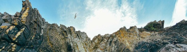
Interview: Dr. Folarin Kolawole; National Geographic Society Wayfinder Award Winner
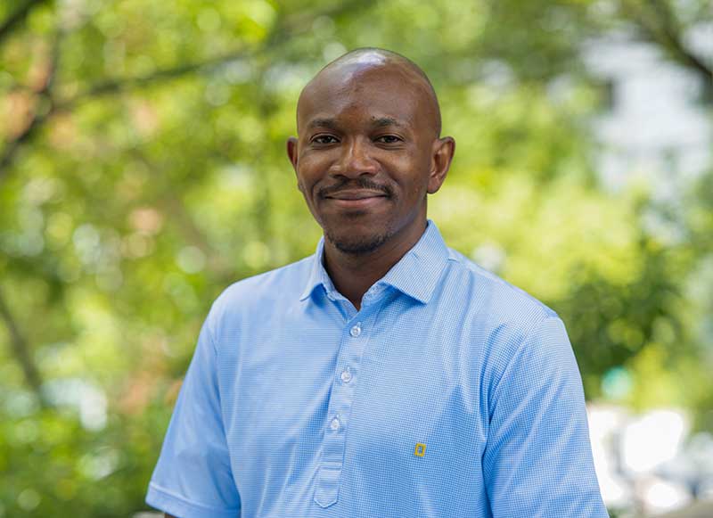
Dr Kolawole concurrently serves as a Columbia professor at the prestigious Lamont-Doherty Earth Observatory (LDEO), where he investigates the physics of continental splitting and hidden intraplate earthquakes.
In June 2026, Dr. Kolawole was named a recipient of the prestigious National Geographic Society Wayfinder Award, which honors 15 global visionaries expanding our understanding of the planet. Also, he also received the American Geophysical Union's (AGU) Jason Morgan Early Career Award for his exceptional contributions to tectonophysics, education, and outreach, and was recently named as the Geological Society of America's 2026 recipient of the Seth and Carol Stein Early Career Award in Geophysics and Geodynamics.
He researches how continental plates stretch and break apart (continental rifting) and how ancient, deeply buried fault zones reactivate to cause intraplate earthquakes far from modern plate boundaries. His active structural geology campaigns span the East African Rift System, the Rio Grande Rift in the United States, Central and Eastern U.S. basins, and rifted margins across West and Southern Africa.
Following the notable 4.8 magnitude earthquake that struck the New York/New Jersey area, Dr. Kolawole has led critical local field operations mapping hidden causative active fault zones in the cold, dense crust of the Greater New York region— a region which was shaped by continental rifting about 200 million years ago.
1. Tell us about your journey to becoming a prominent structural geologist and geophysicist
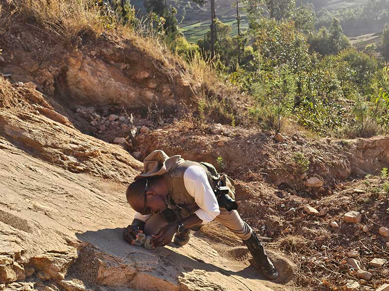
My journey began with a geology degree from the Federal University of Technology, Akure, in Nigeria, where my undergraduate thesis research focused on investigating the multiscale fracturing of an exhumed 500 million-year-old frozen granitic magma chamber in southwest Nigeria. After gaining about four years of industry work experience in geophysical exploration of the Niger Delta Basin, I moved to the United States to earn an M.S. in Geophysics from Oklahoma State University, where I was introduced to continental rifting and dedicated time analyzing geological and geophysical datasets from the East African Rift System.
Afterwards, I obtained a Ph.D. in Geophysics from the University of Oklahoma, where my research focused on earthquake geology, specifically unraveling the nature of the faults that are breaking induced earthquakes in the central United States. After my PhD, I returned to the energy industry and worked with BP America in Houston as an exploration geologist, where I worked extensively on hydrocarbon-hosting rift basins offshore Brazil.
After two years in the industry, I returned to academia to start an Assistant Professor of Geology position at Columbia University in 2022. At Columbia University, I lead the Crustal Deformation Lab group where I work with passionate and amazing colleagues, students, and postdocs to advance the understanding of the physics of continental rifting and earthquake processes.
2. Did you have any role models that guided you to focus on geology?
Yes, I was very lucky to have great mentors and geology role models early on during my undergraduate days when Prof. Odeyemi and Prof. Anifowose were quite inspirational by encouraging me to ask difficult science questions and seek out answers to those questions through extensive reading of existing scientific literature and careful collection and analysis of field geological data. Throughout graduate school, I was also fortunate to have mentors and advisors that inspired me and role-modeled scientific excellence, vision, and purpose for me. These people include Profs. Estella Atekwana, Christopher Jackson, Brett Carpenter, Ze'ev Reches, Eliot Atekwana, Mohamed Abdel Salam, Jake Walter, and Christie Rowe. The rich mentorship, coaching, role modeling, and advice from these people at different times in my academic journey brought me to where I am today.
3. In June 2026, you were named a recipient of the prestigious National Geographic Society Wayfinder Award, which honors 15 global visionaries expanding our understanding of the planet. What does this award mean to you?
Winning the National Geographic award is deeply fulfilling for me, primarily because it brought back rich memories of why I became a geologist. Back when I was in senior high school in Nigeria, my decision to study Geology in college was driven by two factors: 1) a passionate geography teacher who got me intrigued about the natural wonders of the Earth's landforms, and 2) a two-year National Geographic Magazine subscription gift from my dad's friend that demonstrated how geologists tell the intricate stories of how our planet works using compelling photography and illustrations.
I can say that those intriguing monthly magazines germinated the 'seeds' that my high school geography teacher sowed, which ultimately lit up an unquenchable passion to explore the great outdoors and find answers to longstanding science questions. In addition, in such as time as we are now, where research funding is severely limited, the award provides the much need grant to pursue my bold ideas for unraveling key questions on how continents break apart.
4. I attended your public lecture about the notable 4.8 magnitude earthquake that struck the New York/New Jersey area. What are the hidden active fault zones in the cold, dense crust of the Greater New York region?
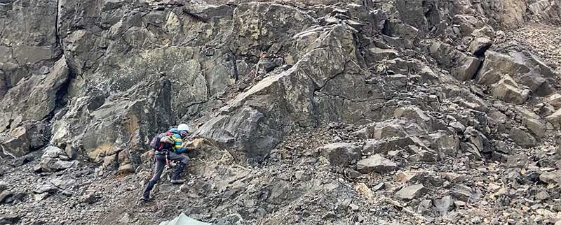
Our research found that the earthquake ruptured due to slip on an ancient fault in the area. We found that the current earthquake-hosting faults developed about 200 million years ago when the African continent rifted away from North America. These ancient faults extend deep into the crust, and the constant passive pushing of the tectonic plate puts stresses on these faults to the extent that they can slip and break energetic earthquakes with additional stress perturbations.
5. Over the past month (late June to July 2026), worldwide monitoring networks recorded about 3 to 4 major earthquakes of magnitude 7.0 or higher and roughly 10 to 15 strong earthquakes between magnitude 6.0 and 6.9. Today there was a 7.1 earthquake in Japan alone. Is there a reason for this seemingly increased activity? Can the major South American earthquakes trigger an earthquake in the NY/NJ region?
Until further analysis, we cannot say for sure that there is a causative relationship between these events. However, it is well known that the propagation of surface waves from major earthquakes over long distances can trigger earthquakes on already critically stressed faults. So, it would be interesting to see what the results of ongoing analyses by seismologists show.
6. This year the United Nations Climate Change Conference (COP31) will take place in Antalya, Turkiye. The focus of two science flags I designed for LDEO on exhibit at the cafeteria. Anatolia sits on a moving microplate squeezed by major regional tectonic forces, shaped primarily by the North Anatolian Fault, the East Anatolian Fault, and the Hellenic-Cyrean subduction zone system. How does this impact the region’s earthquake risk?
The Anatolian fault system defines a transform plate boundary, similar to the San Andreas Fault in western US. Along transform plate boundaries, the plates are shifting side-by-side, which allows for long-range slip on the plate boundary faults, thus suggesting that large earthquakes will be common place in such a tectonic setting.
7. What was the strongest earthquake on earth?
The strongest earthquake ever recorded on Earth was the 1960 Magnitude 9.5 Valdivia earthquake in Chile. The earthquake occurred within the 'ring of fire' which is the system of subduction zones that surround the Pacific Ocean and host the strongest earthquakes recorded in the world.
8. Can we expect a stronger one as a result of global warming?
Our current understanding of the effects of climate change suggests that in certain places, the removal of ice sheets will trigger an adjustment of lithospheric stress, which may induce earthquakes. However, it is not yet known if climate change will trigger larger earthquakes.
9. How can people reach you?
w: www.folarinkolawole.com
e: fola@ldeo.columbia.edu, fk2432@columbia.edu
Glossary Terms:
Selva Ozelli Esq, CPA is a legal and finance executive with diversified experience dealing with highly complex issues in the field of international taxation and related matters within the banking, securities, Fintech, alternative and traditional investment funds. Her first of its kind legal analyses involving tax laws, Foreign Corrupt Practices Act (FCPA), blockchain technology, solar technology and the environment and have been published in journals, books and by the OECD. Her writings have been translated into 15 languages.
